Philippines Mindanao: Magnitude 7.8 Earthquake Triggers Deadly Tsunami
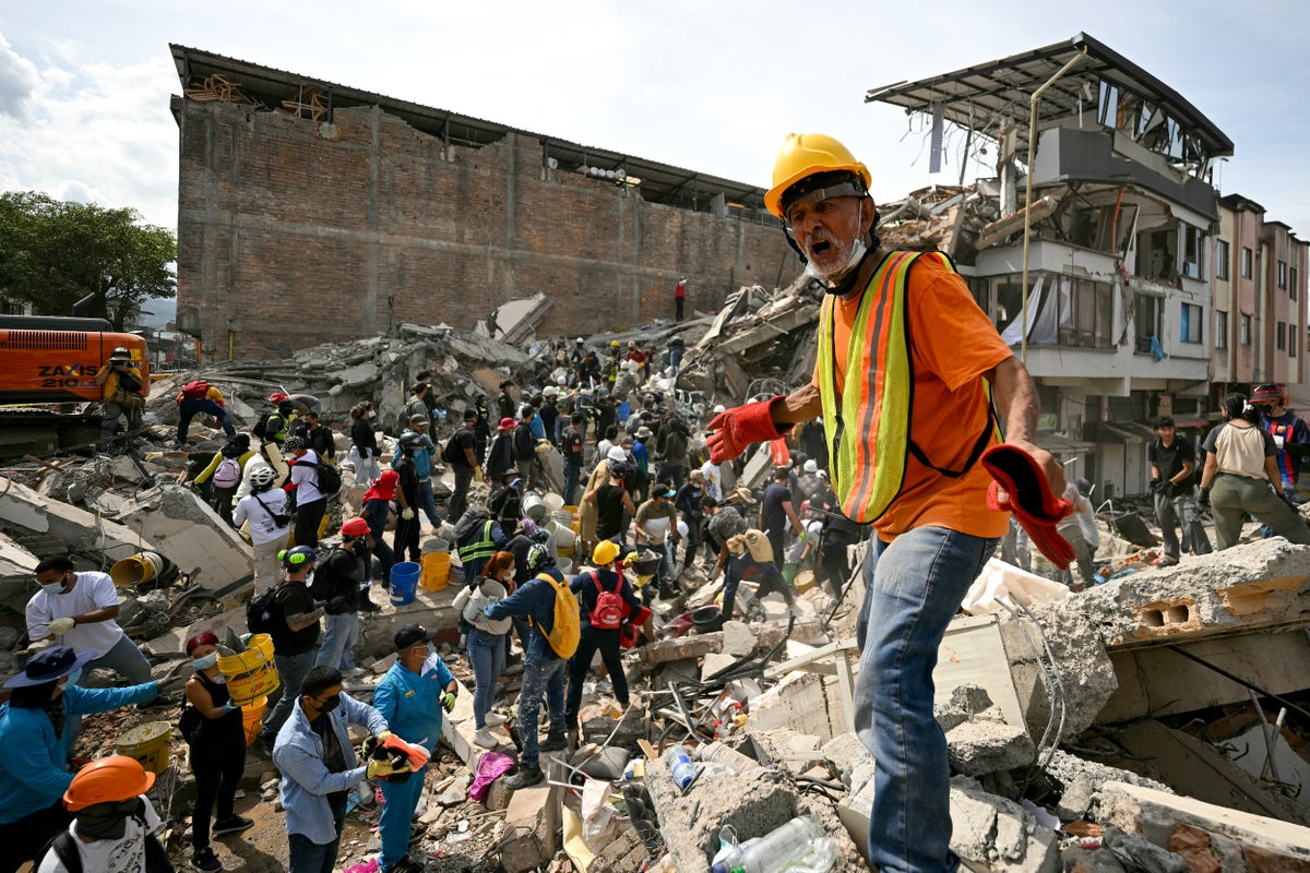
A powerful magnitude 7.8 earthquake struck offshore southern Mindanao, Philippines, on June 8, 2026, triggering tsunami warnings across multiple countries. The disaster caused widespread destruction, significant casualties, and displacement, prompting urgent humanitarian responses and ongoing recovery efforts.
Key Highlights
- Magnitude 7.8 earthquake hit Mindanao, Philippines on June 8, 2026.
- Tsunami warnings issued across the region, with waves observed.
- Over 100 people died, and hundreds more were injured and displaced.
- Widespread damage to buildings, roads, and critical infrastructure.
- Ongoing humanitarian aid and recovery efforts are underway in affected areas.
- Thousands of aftershocks have continued since the main seismic event.
On June 8, 2026, a powerful magnitude 7.8 earthquake struck offshore southern Mindanao in the Philippines at 07:37 AM Philippine Standard Time (PST), causing extensive devastation and triggering widespread concerns across the region. The United States Geological Survey (USGS) and the Philippine Institute of Volcanology and Seismology (PHIVOLCS) identified the epicenter approximately 25 kilometers southwest of Kablalan or 32 kilometers south of Maasim, Sarangani, with a depth of around 33 to 57 kilometers.
The seismic event generated significant shaking across several regions, including SOCCSKSARGEN, the Davao Region, Zamboanga Peninsula, Northern Mindanao, and Caraga, with the strongest intensities reported in Sarangani, South Cotabato, and Davao Occidental, and as far as Eastern Visayas. General Santos City, a major urban center in southern Mindanao, experienced 'very strong' shaking, leading to the collapse of commercial buildings and severe damage to infrastructure. Videos verified by The Guardian showed the upper floor of a Jollibee restaurant collapsing and outer concrete walls of a commercial complex giving way in General Santos City. Hospitals and schools also sustained structural damage, necessitating evacuations and temporary operational shifts.
Following the earthquake, tsunami warnings were immediately issued for nine coastal provinces in the southern Philippines, including Sarangani, Davao Occidental, Tawi-tawi, Sulu, Basilan, Zamboanga Del Sur, Zamboanga Sibugay, Sultan Kudarat, and South Cotabato. Residents in these low-lying coastal areas were strongly advised to evacuate immediately to higher ground or move farther inland. Tsunami waves were indeed observed, reaching heights of up to 1.48 meters along the coast of Sarangani Province and 0.84 meters in Sultan Kudarat Province. Smaller waves were also recorded in Zamboanga and Mati in Davao Oriental Province. The tsunami alert was eventually lifted eight hours after the earthquake. Beyond the Philippines, tsunami advisories were issued for northern Indonesia and the Malaysian state of Sabah, where residents were also told to evacuate. Even Japan's Pacific coast received tsunami advisories, and the US National Tsunami Warning Center assessed concerns for the US Pacific coast, though ultimately determining no tsunami danger for the US West Coast, British Columbia, or Alaska, only non-damaging sea level changes.
The human toll of the disaster was substantial. Initial reports indicated varying casualty figures, with some reporting at least three deaths and others fifteen deaths and 129 injured. However, as search and rescue operations progressed and assessments were conducted, the death toll rose significantly. By June 9, 2026, the United Nations Population Fund (UNFPA) reported 37 confirmed deaths and 456 injuries, affecting 145,693 individuals. The Guardian reported at least 37 deaths with hundreds injured, and civil defense officials were verifying preliminary reports of 479 injured and four missing across Mindanao. ReliefWeb later indicated 19 people dead, 12 missing, and 134 injured based on initial reports, with figures for affected and displaced people pending validation. The most comprehensive update, from Wikipedia, citing later reports, states at least 106 people died, over 1,300 were injured, and 7 were reported missing in Mindanao. Approximately 88,000 people were affected, including 20,690 displaced, with over 31,701 individuals forced to shelter in 54 evacuation centers. Women and girls were disproportionately affected, facing heightened protection risks in overcrowded evacuation centers.
The earthquake also inflicted widespread damage to essential infrastructure, including collapsed buildings, damaged roads and bridges, and disrupted power and communication lines. Glan and Maasim municipalities in Sarangani province were among the hardest-hit areas, facing continuing aftershocks, landslides, and disruptions to essential services. Over 5,000 aftershocks have been recorded since the main earthquake by June 24, 2026, significantly impeding recovery efforts and maintaining a high risk for coastal communities.
In response to the crisis, the Government of the Philippines activated emergency response mechanisms, deploying first responders and coordinating search and rescue operations. National and local authorities worked to deliver relief items to severely affected areas by air, sea, and land. International organizations quickly mobilized aid; International Medical Corps deployed teams to Sarangani province to provide essential medicine, medical supplies, and hygiene kits, while UNFPA focused on ensuring access to sexual and reproductive health services and support for survivors of gender-based violence. CARE Philippines also coordinated with local governments and disaster risk reduction authorities to assess needs and provide assistance. Humanitarian snapshots and situation reports continue to be published by organizations like OCHA and DSWD, indicating ongoing monitoring and response efforts into August 2026.
Frequently Asked Questions
What was the magnitude and epicenter of the earthquake?
A powerful magnitude 7.8 earthquake struck offshore southern Mindanao, Philippines, on June 8, 2026. The epicenter was located approximately 32 kilometers south of Maasim, Sarangani, at a depth of about 33 kilometers.
Did the earthquake trigger a tsunami?
Yes, the earthquake triggered tsunami warnings for nine coastal provinces in the southern Philippines. Tsunami waves of up to 1.48 meters were recorded along the coast of Sarangani Province, and advisories extended to Indonesia and Malaysia.
What was the human toll of the disaster?
The disaster resulted in at least 106 deaths, over 1,300 injuries, and 7 people reported missing in Mindanao. Approximately 145,693 individuals were affected, with over 31,701 displaced and sheltering in evacuation centers.
What kind of damage did the earthquake and tsunami cause?
The earthquake caused widespread destruction, including collapsed buildings, damaged roads, bridges, and disruptions to power and communication lines. Hospitals and schools also sustained structural damage, significantly hindering essential services.
What are the ongoing recovery efforts?
The Philippine government, along with international humanitarian organizations like UNFPA, International Medical Corps, and CARE Philippines, has launched extensive relief operations. Efforts include search and rescue, delivery of essential aid, medical support, and providing assistance to displaced populations amidst continuing aftershocks.