NASA and IBM's Prithvi: First Geospatial AI Foundation Model in Orbit
NASA and IBM have successfully deployed Prithvi, the first geospatial AI foundation model, into Earth's orbit. This open-source model, trained on 13 years of satellite data, promises real-time Earth observation for critical applications like disaster response and climate monitoring, revolutionizing how we analyze planetary changes.
Key Highlights
- NASA and IBM launched Prithvi, the first geospatial AI foundation model, into orbit.
- Deployed on ISS and Kanyini satellite for real-time Earth data analysis.
- Trained on 13 years of NASA/ESA satellite imagery, enhancing various applications.
- Improves flood mapping, disaster monitoring, and crop yield predictions globally.
- Its open-source nature facilitated rapid adaptation for in-orbit processing on limited hardware.
- Onboard processing reduces data downlink, providing faster environmental insights.
In a significant leap for Earth observation and artificial intelligence, NASA and IBM have successfully deployed Prithvi, the first-ever geospatial AI foundation model, into Earth's orbit. This groundbreaking achievement marks a new era in monitoring our planet, enabling real-time analysis of vast amounts of environmental data.
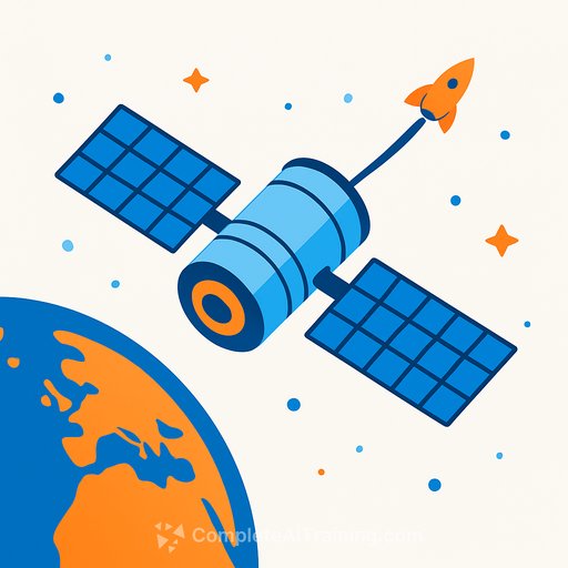
The Prithvi Geospatial AI foundation model, developed through a collaborative effort between NASA's IMPACT AI team and IBM Research, was launched aboard two in-orbit platforms: the South Australian government's Kanyini satellite and the Thales Alenia Space IMAGIN-e payload on the International Space Station (ISS). This dual deployment demonstrates the model's versatility across different computing environments in space.
The core strength of Prithvi lies in its extensive training data. The model was trained on an unprecedented 13 years' worth of global geospatial data, specifically from NASA's Harmonized Landsat and ESA (European Space Agency) Sentinel-2 satellites. This massive dataset allows Prithvi to understand and generalize complex patterns across various Earth observation tasks without needing to be retrained from scratch for each specific application.
One of the most crucial aspects of the Prithvi model is its open-source nature. Kevin Murphy, chief science data officer at NASA Headquarters, emphasized that making these AI models open-source accelerates scientific and technological development by allowing anyone to use and build upon them. This open availability was instrumental for researchers from the University of Adelaide and the SmartSat Cooperative Research Centre in South Australia, who adapted a compressed version of Prithvi for deployment on the resource-constrained satellite hardware. This adaptation saved years in the deployment timeline, demonstrating the power of collaborative and open science.
Before its in-orbit deployment, NASA and IBM initially made their geospatial foundation model openly available on Hugging Face in August 2023, marking it as the largest geospatial foundation model on the platform and the first open-source AI foundation model built in collaboration with NASA. An updated version, Prithvi-EO-2.0, was subsequently released in December 2024, boasting improved performance and a larger parameter count.
The applications of Prithvi are far-reaching and hold immense potential for addressing critical environmental challenges globally, including those faced by countries like India. The model can be fine-tuned for a wide variety of tasks, such as accurately mapping flood plains, monitoring disaster areas for rapid response, detecting cloud cover, and predicting crop yields. For instance, in-orbit tests successfully demonstrated Prithvi's ability to predict burn scars from wildfires and detect floods, showcasing its predictive power and utility in disaster assessment.
The primary advantage of deploying a foundation model like Prithvi directly in orbit is the ability to perform advanced data analysis before the information even reaches the ground. Earth-observing satellites collect massive amounts of data, and traditionally, this raw imagery is transmitted to ground stations for processing. This process is often hampered by bandwidth limitations, which restrict the size of software updates and the complexity of AI models that can be used on satellites. By processing data onboard, Prithvi significantly reduces downlink bandwidth demands, enabling faster autonomous responses for time-critical applications such as wildfire detection, flood mapping, and crop stress monitoring. This real-time capability is particularly vital for disaster management, where every minute saved can help mitigate damage and save lives.
Beyond immediate Earth observation, the successful demonstration of Prithvi in orbit paves the way for future advancements. Researchers envision a future where operators can interact with satellites using natural language, asking questions about onboard data or system status and receiving conversational responses. This development also validates a deployment pathway for planetary science missions, where communication delays make onboard inference a necessity. The NASA team behind Prithvi is already working on similar open-source foundation models for other scientific domains, including heliophysics (Surya model released in 2025), planetary science, astrophysics, and biological and physical sciences.
This pioneering effort by NASA and IBM, with significant contributions from Australian research institutions, is set to revolutionize how humanity understands and responds to the dynamic changes on our planet, making critical environmental insights more accessible and actionable globally.
Frequently Asked Questions
What is Prithvi and why is its deployment in orbit significant?
Prithvi is the first geospatial AI foundation model developed by NASA and IBM that has been successfully deployed in Earth's orbit. Its significance lies in its ability to perform advanced Earth observation data analysis directly in space, reducing the need to send large amounts of raw data back to Earth and enabling faster, more autonomous responses to critical environmental events.
How was Prithvi developed and what data was it trained on?
Prithvi was developed through a collaboration between NASA's IMPACT AI team and IBM Research. It was trained on an extensive dataset of 13 years' worth of global geospatial data from NASA's Landsat and the European Space Agency's (ESA) Sentinel-2 satellites.
What are the key applications of the Prithvi AI model?
Prithvi is designed to facilitate a wide range of Earth observation tasks. These include accurate flood mapping, effective disaster monitoring and response, precise cloud detection, and improved prediction of crop yields, all crucial for managing environmental challenges globally.
Where exactly was Prithvi deployed in orbit?
A compressed version of the Prithvi model was deployed on two orbital platforms: the South Australian government's Kanyini satellite and the Thales Alenia Space IMAGIN-e payload, which is aboard the International Space Station (ISS).
What role does open-source play in Prithvi's development and deployment?
Prithvi is an open-source AI model, which was critical for its development and successful in-orbit deployment. Its open availability on platforms like Hugging Face allowed researchers, particularly from Australia, to adapt and optimize the model for satellite hardware, accelerating the process and fostering broader scientific collaboration.